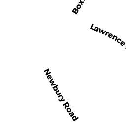
1 LAWRENCE RD
Owner Information
WEED PAUL A
1 LAWRENCE RD
ROWLEY, MA 01969


Property Details
1 LAWRENCE RD is classified as a Single Family Residential (Split-level).
The primary structure on this property was built in 1970. There are 2,572ft2 of built area within this property. There is 1,122ft2 of residential/living space within this property. This property is listed as having 5 rooms.
1 LAWRENCE RD is valued at $368,400. The land is valued at $162,300 and the structures are valued at $205,400. There is an additional valuation of $700 on this property.
This property is in Zone OUT. Confirm with local Zoning Board authorities to ensure there are no overlays or other easements on this property.
The most recent deed for 1 LAWRENCE RD is recorded at the local registrar in Book 7117, Page 222. 1 LAWRENCE RD was last sold on Wednesday, May 25, 1983 for $20,000.
Assessment data from fiscal year 2021.
Flood Data
According to the FEMA National Flood Hazard Layer, this property does not appear to be in a flood zone. It may also be in an area not yet reviewed. Nonetheless, confirm this information prior to taking any action.
To view the flood hazards around this property, create a FEMA "Firmette" Map of the area around 1 LAWRENCE RD.
Broadband Internet Providers
| Provider | Type | Bandwidth (mbps) | |
|---|---|---|---|
| HughesNet | Satellite | 25 | 3 |
| Comcast | Cable | 1000 | 35 |
| Verizon New England Inc. | Fiber | 940 | 880 |
| Viasat Inc | Satellite | 100 | 3 |
| VSAT Systems, LLC. | Satellite | 2 | 1 |
| Verizon New England Inc. | DSL | 5 | 0 |
| GCI Communication Corp. | Satellite | 0 | 0 |
Broadband service provider data from December 2020.
Adjacent Properties
- 48 BOXFORD RD
Single Family Residential owned by TRS HJT REALTY TRUST - 15 LAWRENCE RD #17
Residential Condominium owned by DORAZIO CATHERINE M - 15-20 LAWRENCE RD MASTER CARD
Other, Open Space owned by BROOKWOOD CONDOS - 15 LAWRENCE RD #26
Residential Condominium owned by COMO RAYMOND M - 15 LAWRENCE RD #27
Residential Condominium owned by PENDAK JARED - 15 LAWRENCE RD #28
Residential Condominium owned by SEDERQUIST HOWARD - 15 LAWRENCE RD #29
Residential Condominium owned by WING ANN M - 15 LAWRENCE RD #30
Residential Condominium owned by RICHARDS JAMIE - 15 LAWRENCE RD #31
Residential Condominium owned by FLYNN CATHERINE M - 15 LAWRENCE RD #32
Residential Condominium owned by DREW DIANE - 15 LAWRENCE RD #18
Residential Condominium owned by MCKINNON CYNTHIA R - 15 LAWRENCE RD #20
Residential Condominium owned by LEWIS ELIZABETH A - 15 LAWRENCE RD #21
Residential Condominium owned by BROWN SUSAN W - 15 LAWRENCE RD #22
Residential Condominium owned by DACUNTO CARRIE A - 15 LAWRENCE RD #23
Residential Condominium owned by DEMARCO VICTORIA A - 15 LAWRENCE RD #24
Residential Condominium owned by ELLIS MICHAEL E - 15 LAWRENCE RD #25
Residential Condominium owned by LANE ROBERT M - 20 LAWRENCE RD #01
Residential Condominium owned by WALLSTEDT NORMAN A - 20 LAWRENCE RD #11
Residential Condominium owned by INGERSOLL DAVID - 20 LAWRENCE RD #12
Residential Condominium owned by GRIFFIN MARK - 20 LAWRENCE RD #13
Residential Condominium owned by PUNDT ELISABETH E - 20 LAWRENCE RD #14
Residential Condominium owned by SCOTTI ARTHUR - 20 LAWRENCE RD #15
Residential Condominium owned by WEDGE JUDITH A - 20 LAWRENCE RD #16
Residential Condominium owned by WALSH DAVID A - 20 LAWRENCE RD #02
Residential Condominium owned by GOSSELIN MARY JEAN - 20 LAWRENCE RD #03
Residential Condominium owned by DIECIDUE NESE - 20 LAWRENCE RD #04
Residential Condominium owned by BAKER SMITH STEPHANIE - 20 LAWRENCE RD #05
Residential Condominium owned by MURPHY MEGAN - 20 LAWRENCE RD #06
Residential Condominium owned by ORRELL CHARLES J - 20 LAWRENCE RD #07
Residential Condominium owned by ORRELL JANINE M - 20 LAWRENCE RD #08
Residential Condominium owned by FREEDMAN MARC P - 20 LAWRENCE RD #09
Residential Condominium owned by COUSINS MARK E - 15 LAWRENCE RD #19
Residential Condominium owned by DAGLE CAROL A - 20 LAWRENCE RD #10
Residential Condominium owned by DAY LINDA A